Engineering Geospatial Features
PostGIS is a PostgreSQL database extension that adds support for geographic objects and provides extensive functionality for representing and analyzing spatial data.
Engineering Point Locations from Latitude and Longitude values
If you have Latitude and Longitude values (and know the Spatial Reference ID, aka SRID, of the system that produced those values), you can produce a geometric Point representing the location for each (Latitude, Longitude) pair.
SELECT
    parcel_location_id,
    pin,
    ST_SetSRID(ST_MakePoint(longitude, latitude), 4326) AS geometry
FROM clean.cook_county_parcel_locations_clean
Engineering Boundaries from Point Locations
There are a number of algorithms for producing polygons from sets of points.
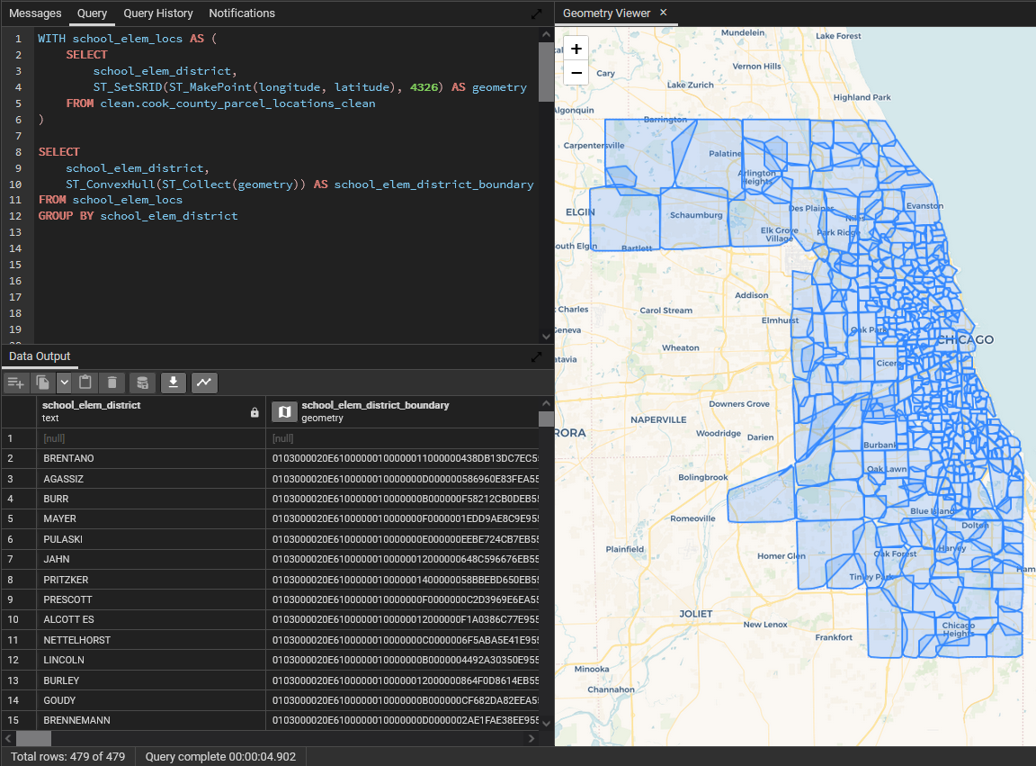
Convex Hull
The Convex Hull algorithm produces a polygon by connecting the outermost points in a group. The ConvexHull algorithm is computationally inexpensive, but it will typically produce overlapping polygons.
As a mental heuristic, this algorithm produces a polygon by looping a string around all of the points and pulling tight.
WITH school_elem_locs AS (
    SELECT
        school_elem_district,
        ST_SetSRID(ST_MakePoint(longitude, latitude), 4326) AS geometry
    FROM clean.cook_county_parcel_locations_clean
)

SELECT
    school_elem_district,
    ST_ConvexHull(ST_Collect(geometry)) AS school_elem_district_boundary
FROM school_elem_locs
GROUP BY school_elem_district
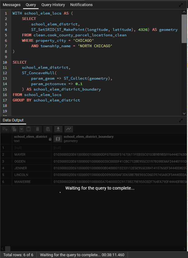
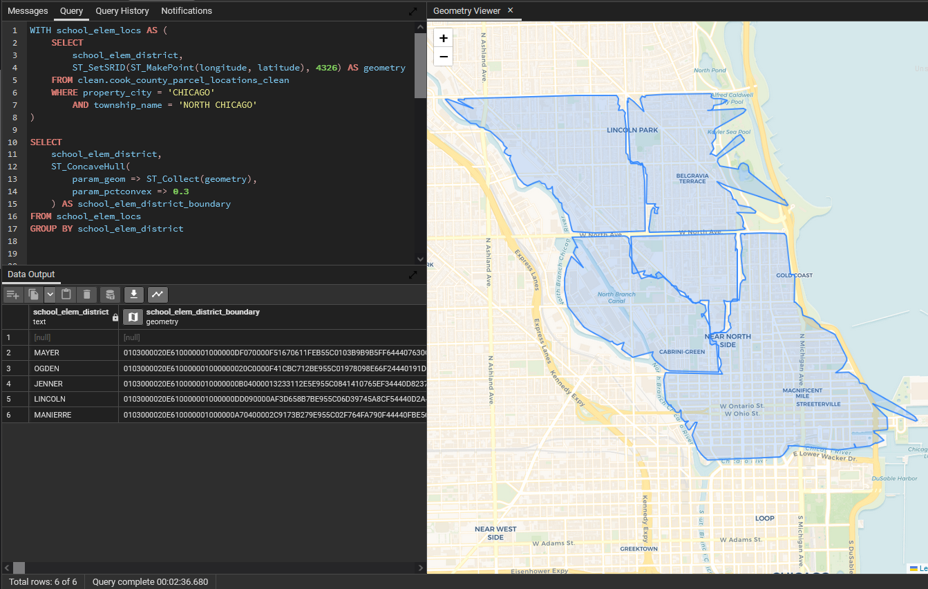
Concave Hull
The Concave Hull algorithm is much (MUCH) more computationally intensive and typically requires some experimentation to dial in the parameters, but it can produce much more complex polygons. The param_pctconvex parameter accepts values from 0 to 1, and the lower the value, the shorter the gap between perimeter points before the edge will erode (and the longer the calculation will take).
SELECT
    school_elem_district,
    ST_ConcaveHull(
        param_geom => ST_Collect(geometry),
        param_pctconvex => 0.25,
         param_allow_holes => false
    ) AS school_elem_district_boundary
FROM school_elem_locs
GROUP BY school_elem_district
Warning: This algorithm is exceptionally slow over large sets of points. If you absolutely need to use this algorithm, minimize the number of points in the calculation, and start with a higher param_pctconvex value and reduce it if needed. For reference, running this query over ~78k points with param_pctconvex set to 0.3 took just over 2.5 minutes to finish, but when set to 0.1, it hadn't finished after 38 minutes.
Other Polygon-producing Algorithms
There are a few other noteable algorithms for engineering polygons from points, namely variants of Alpha Shape, but they require the SFCGAL PostgreSQL extension which isn't currently included in the PostGIS database container (although adding it would be fairly easy for new ADWH instances).